
Like us on Facebook
PLACE NAMES


|
|
Aisey-sur-Seine
|
|
|
Aisey-sur-Seine is located some 12 km south of Chatillon-sur-Seine and about 25 km north-east of Montbard. The commune can be reached by travelling east from Coulmier-le-Sec on Highway D29 which passes through the heart of the commune and the town before continuing east to join Highway D16 near Saint-Germain-le-Rocheux. The commune can also be accessed from the north on Highway D971 (the Route de Dijon) from Nod-sur-Seine. Highway D971 continues through the town and commune south to Saint-Marc-sur-Seine. Other highways entering the commune are the D101A from Chemin-d'Aisey in the south-west and the D29C cross-country road from Nod-sur-Seine which joins Highway D29 in the commune. The commune has large areas of forest - especially in the east and the south with some farmland on the western side.
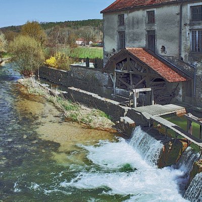
The commune is traversed by the Seine river which forms part of the south-eastern boundary before passing northwards through the town then along a part of the northern border before continuing north to Chamesson. The Brevon Stream which forms the south-eastern boundary of the commune joins the Seine near the intersection of Highway D29 and D101 (a side road from the D971).
Formerly known as Aisey-le-Duc. In the Middle Ages, Aisey-sur-Seine was the seat of a lordship. There is a well-preserved Fortified house with a game park.
 Feel free to Email me any additions or corrections Feel free to Email me any additions or corrections
LINKS AVAILABLE TO YOUR SITE
| | |
