Île d'Oléron is an island off the Atlantic coast of France (due west of Rochefort), on the southern side of the Pertuis d'Antioche strait.
It is the second largest island of Metropolitan France, after Corsica.
The island has an area of about 174 sq km. It is a fertile and well cultivated island on the Atlantic coast of France, that is on the Bay of Biscay.
The climate is generally mild (maritime temperate) with sufficient but not excessive rainfall, but with probably from 3 to 15 days of intense heat in the summer months of July and August, mostly grouped.
In the 7th and 8th century, the island, along with Ré, formed the Vacetae Insulae or Vacetian Islands, according to the Cosmographia. Vaceti being another name for the Vascones, the reference is evidence to Basque (Gascon) settlement or control of the islands by that date.
It was at Oléron in about 1152 to 1160 that Eleanor of Aquitaine introduced the first 'maritime' or 'admiralty' laws in that part of the world: the Rolls of Oleron. In 1306, Edward I of England granted the island to his son, Edward II, as part of the Duchy of Aquitaine.
On 20 March 1586, the island was taken by Agrippa d'Aubigné.
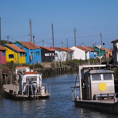
As a large Atlantic island only 3 kilometres off the Aquitanian coast of France, Oléron is a popular tourist destination. Several companies operate boat trips from the towns of Boyardville and Saint-Denis to the nearby Ile d'Aix, La Rochelle, and past the Fort Boyard. The port towns are frequently visited by tourists, especially the village of La Cotiniere. This village is the base for a hundred trawlers who sell their fish every day at 05:00 and 16:00h. La Cotiniere was the first fishing port in the department of Charente-Maritime, and the 8th of France.
 Feel free to Email me any additions or corrections Feel free to Email me any additions or corrections
LINKS AVAILABLE TO YOUR SITE
| |