|
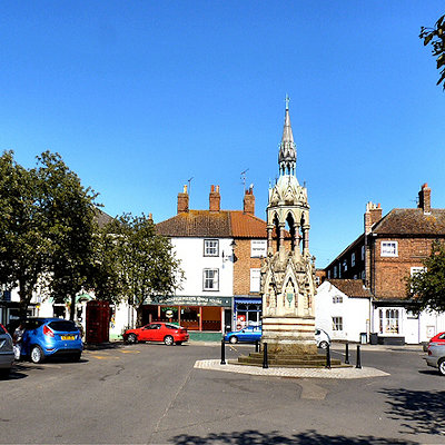
Horncastle is a market town in the East Lindsey district of Lincolnshire, England. It is situated 17 miles (27 km) geographically east, and 22 miles (35 km) by road, from the city and county town of Lincoln. Horncastle has a population of 6,651 residents.
It lies to the south of the Lincolnshire Wolds, where the (north-south) River Bain meets the River Waring (from the east), and north of the West and Wildmore Fens. The south of Horncastle is called Cagthorpe. Langton Hill is to the west. It used to be part of Horncastle Rural District in the Parts of Lindsey, but is now in the district council of East Lindsey, based in Manby, east of Louth.
North of the town, the civil parish meets West Ashby and Low Toynton, south of Milestone House on the A153 (Louth Road). The boundary skirts the east of the town, crossing Low Toynton Road, following the Viking Way then meeting the River Waring. It briefly follows north of the A158, to a caravan park, where it meets High Toynton. Southwards on Mareham Road it meets Mareham on the Hill, east of Stonehill Farm. South of the town, and north of Telegraph House, it meets Scrivelsby, following High Lane westwards to cross the B1183, south of Loxley Farm, then the A153 and skirts the southern edge of the sewage works next to the River Bain where it meets Roughton (Thornton). It follows the Old River Bain west of the A153 northwards across the river meadows, crossing the Horncastle Canal (and Viking Way). Eastwards it crosses the B1191, south of Langton Hill, where at Lowmoor Lane it meets Langton. It follows Langton Lane northwards, with Mill House Farm (Langton Mill) to the west, meeting Thimbleby. It meets the B1190 where the pylons cross the road then the A158 at the B1190 junction, briefly following Accommodation Road to the east. It skirts the north of the town, briefly following Elmhurst Road, passing south of Elmlea Farm. and straight through Elmhirst Lakes. At the River Bain near Hemingby Lane, it meets West Ashby.
In Domesday, it was Hornecastre, the place built on a "horn" of land between two rivers Bain and Waring.
|