Like us on Facebook
PLACE NAMES


|
|
Ruislip
|

|
|
|
Ruislip is a town in West London, England, which is part of the London Borough of Hillingdon.
It was formerly a parish in the county of Middlesex covering the neighbouring areas of Eastcote, Northwood, Ruislip Manor and South Ruislip. The parish appears in the Domesday Book, and some of the earliest settlements still exist today, designated as local heritage sites. The parish church, St Martin's, dates back to the 13th century and remains in use. The buildings at the northern end of Ruislip High Street form the core of the original village square and are now Grade II listed. It originally featured a central water pump which was moved out of the road in the 1970s as a result of increased traffic.
The expansion of the Metropolitan Railway in the early 20th century acted as a catalyst for development in the area. A station was opened in Ruislip in 1904 and the parish council created a new urban district to address the forthcoming population growth. The Ruislip-Northwood Urban District continued until 1965 when Ruislip became part of the newly established London Borough of Hillingdon. Between 1911 and 1961, Ruislip-Northwood experienced a significant rise in population, from 6,217 to 72,791, largely attributed to the extension of the railway.
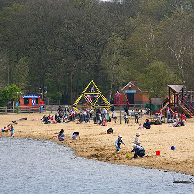
Major landmarks in the area include Ruislip Lido, a former reservoir, now an area of public parkland with its own miniature railway and Manor Farm, a settlement dating from the 9th century which is now designated as a local heritage site. Ruislip is included within the Ruislip, Northwood and Pinner Parliament constituency and is covered by three electoral wards within the local council.
At the time of Edward the Confessor, the parishes of Ruislip and Ickenham belonged to a Saxon named Wlward Wit, a thane of the king who owned land in 11 counties. Ruislip parish included what is now the modern Ruislip, Northwood, Eastcote, Ruislip Manor and South Ruislip. Wit lost much of his land during the Norman conquest of England; Arnulf de Hesdin took control of Ruislip - his ownership is recorded within the 1086 Domesday Book.
Ruislip appears in the Domesday Book as Rislepe, thought to mean 'leaping place on the river where rushes grow', in reference to the River Pinn. It is formed from the Old English 'rysc' and 'hlÿp'. Translated from Latin, an entry reads:
M. Arnulf [Ernulf] of Hesdin holds Rislepe [Ruislip]. It is assessed for 30 hides. Land for 20 ploughs. In lordship 11 hides; 3 ploughs there. There are 12 ploughs between the Frenchmen and the villagers; a further 5 possible.
A priest, ½ hide; 2 villagers with 1 hide; 17 villagers, 1 virgate each; 10 villagers, ½ virgate each; 7 smallholders, 4 acres each; 8 cottagers; 4 slaves; 4 Frenchmen with 3 hides and 1 virgate. Pasture for the village livestock; a park for woodland beasts; woodland, 1500 pigs, and 20d too.
Total value £20; when acquired £12; before 1066 £30.
Wulfward Wight, a thane of King Edward's, held this manor; he could sell it to whom he would.
 Feel free to Email me any additions or corrections Feel free to Email me any additions or corrections
LINKS AVAILABLE TO YOUR SITE
| | |


