
Like us on Facebook
PLACE NAMES


|
|
Todmorden
|
|
View Larger Map |
|
Todmorden - Todd's marshy valley
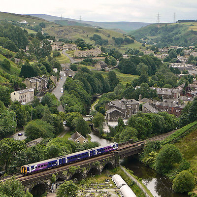
Todmorden is a market town and civil parish within the Metropolitan Borough of Calderdale in West Yorkshire, England. It forms part of the Upper Calder Valley and has a total population of 14,941. It is located 17 miles from Manchester.
Todmorden town centre occupies the confluence of three steep-sided Pennine valleys, which constrict the shape of the town. Todmorden is surrounded by moorlands with occasional outcrops of gritstone sandblasted by winds.
The historic county boundary between Yorkshire and Lancashire is marked by the River Calder and its tributary, the Walsden Water, which runs through the centre of the town. The administrative border was altered by the Local Government Act 1888 placing the whole of the town within the West Riding, whereby today all of Todmorden lies within West Yorkshire.
The town is served by Todmorden railway station and Walsden railway station.
|
 Feel free to Email me any additions or corrections Feel free to Email me any additions or corrections
LINKS AVAILABLE TO YOUR SITE
| |

