
Like us on Facebook
PLACE NAMES


|
|
Le Puisaye
|
|
|
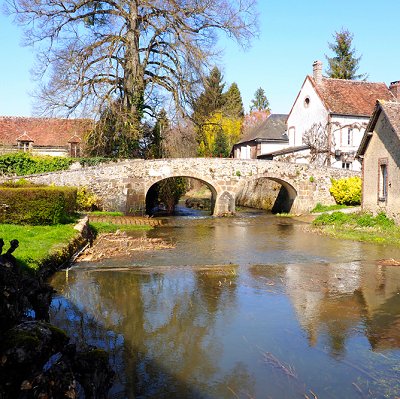
Le Puisaye is a natural and historical region of France, now divided between the départements of Loiret, Nièvre and Yonne. Its historical and administrative center is the town of Saint-Fargeau. Its inhabitants are known as Poyaudins (or Puisayens).
According to local 19th-century historian Ambroise Challe, the name Puisaye first appeared in 12th-century charters. It was variously spelled Poiseia, Puseium, Pusaya, Puiseia, Puteacia, or Poidaceia.
Since the Puisaye is not an administrative region, its exact definition and limits can vary depending on time and context. Its core is a land of forests and ponds, traversed by several rivers including the Loing. It is bordered by Sancerrois to the west across the Loire river, Gâtinais to the northwest, Auxerrois to the northeast, Forterre to the southeast, and Donziais to the south.
The Communauté de communes de Puisaye-Forterre, created in 2017, covers most of the historical Puisaye, though not its Western fringe in the Loiret. It also includes the geologically distinct land of Forterre as well as parts of the Auxerrois, both to the east. The name Puisaye appears to exert a certain attraction, leading communities that are not historically part of Puisaye to adopt it. This has been the case of Sougères-en-Puisaye, which changed its name from Sougères-les-Simon in 1955, and of Charny-Orée-de-Puisaye, which adopted this name when it was formed by the merger of 14 villages in 2016. As a result, the contemporary usage of the word Puisaye can cover a broader territory than has been the case in the past.
The Lac du Bourdon is the largest body of water in Puisaye, albeit far from the only one. It is a reservoir formed in 1901 to help regulate water levels of the Briare Canal. The Bourdon is a small tributary of the Loing that feeds into and from the lake.
Places worth exploring include:
- Charny-Orée-de-Puisaye is a commune in the Yonne department of central France, on the Northern end of the historical region of Puisaye.
- Ferrier of Tannerre-en-Puisaye, an iron mining and working site in Antiquity. The works date from the Gallic and Gallo-Roman times. It is one of two largest ferriers in France and one of the largest in Europe. Industrial exploitation of the site ceased when it was classed as French Heritage monument in 1982.
- Church of the ancient monastery of Moutiers-en-Puisaye, home of Rodulfus Glaber. The parish church is dedicated to Saints Peter and Paul.
- 11th-century keep (tour sarrazine) in Saint-Sauveur-en-Puisaye. In the early 1970s the Château de la Folie, north of the village (halfway to Mézilles) was home to one of the "Maharishi's Science of Creative Intelligence" projects. Transcendental Meditation teachers and students from all over the world gathered here to renovate the buildings and make the château a meditation centre. There were plans to make a campus with meditation-units in the fields between the château and the Etang de la Folie, just beside the D7 road. The project was abandoned in the mid-seventies, for reasons unknown.
- "Bishops' Tower" in Toucy, first built in the 12th century. Toucy was the birthplace and hometown of Pierre Larousse, lexicographer and founder of the publishing house that would later produce one of the most highly popular French dictionaries, Le Petit Larousse.
Léon Noël, French diplomat, politician and historian, died there in his domain in 1987.
- Saint-Loup Church in Bléneau, a commune of around 1,289 inhabitants (in 2017) of the Puisaye area. The commune is on the site of an ancient route that crossed the Loing. The commune covers 3941 hectares and has forests, ponds and grazing lands on its territory. Bléneau is situated at 150 km from Paris, 56 km from Auxerre and 29 km from Gien. Like the rest of Yonne, Bléneau is on the geological region of the Paris Bassin, but the natural area of Puisaye is characterized by the presence of Puisaye sand and the presence of groundwater that permeate the soil. Bléneau thus presents many wetland habitats and meadows on its territory. There is a Natural site of importance (Natura 2000) on the territory of the commune, at the limit of the neighbouring commune of Saint-Privé. That natural site is composed of oligotrophic ponds where littorella plants grow and their adjacent damp meadows. The protected site presents a complexe ensemble of green landscapes, damp or dry, in every stage of plant colonisation.
- Medieval tower at Dammarie-en-Puisaye.
- Saint-Symphorian Church in Treigny, known as the Cathédrale de la Puisaye.
- 15th-century Château de Saint-Fargeau, built by Antoine de Chabannes.
- Château de Saint-Amand-en-Puisaye. In the 10th century, before the construction of the current castle, the château was originally a hunting residence. This was destroyed in the 15th century, and a castle was built on its foundations. This castle was destroyed by fire and replaced by the current castle in the 17th century, with additions and major improvements made in the 19th and 20th centuries. The château has a distinctive design. From above, the château's curtains and towers form an irregular pentagon, the corners of which are formed by six towers of pink brick. Five of the towers are topped with lanterns. The château was designated as a monument historique in 1945 and has been open to the public since.
- Chateau de Lalande, was built in the 1530s by Antoine de Rochechouart (ca. 1488-1544), a scion of the ancient House of Rochechouart. In addition to being lord of Saint-Amand-en-Puisaye, he was Seneschal of Toulouse and Albigeois and Lieutenant-General of Languedoc, Governor of Lomagne and of Rivière-Verdun. He was a significant military figure of the time, participated in the defense of Marseilles in 1536, and died of his wounds at the Battle of Ceresole. After the death of Antoine's widow in 1560, the castle was successively held by several noble families as lords of Saint-Amand. In 1659 the lordship (including the castle) was purchased by Cardinal Mazarin, together with the much larger Duchy of Nevers. Noble Léonard Guyot de Montchougny then acquired it in 1710, and the castle remained in the property of his descendants until 1896. Later owners included a Swedish aristocrat, Count Nils de Brack, a painter and stoneware artist (1926-1930); and Jules Guiraud, a deputy governor of the Banque de France (1935-1947). It was purchased by the town of Saint-Amand in October 1985.
- The seven locks of Rogny-les-Sept-Écluses on the Briare Canal, early 17th century. Rogny-les-sept-écluses was simply known as Rogny before 1978, when the name was changed to mirror its famous monument. Human settlement in the area dates back to Roman times. Medals and coins bearing the image of the Emperor Constantine (306-337) and the Gaulish tyran Tetricus (268) were found along an ancient Roman road. In the Middle Ages, the lower part of the village was on wetlands, so most of the villagers lived around the church on the higher part of the village. Written traces from the 11th century indicate that the village now known as Rogny belonged to the Roignacum parish, from where the name could come. The Briare Canal and its main work, the seven locks, were part of the enormous work of Henry IV and Sully to join the Mediterranean Sea to the English Channel by a network of canals and rivers. The locks were built to join the Loire to the Seine water system. It was Hugues Cosnier's idea to built six locks (a seventh one was built later) to cross the Vallée du Loing (côte Rogny, hence the name Rogny-les-sept-écluses). Cosny had chosen Rogny for its work because of the presence of many ponds, and the water was to be used to operate the locks. Construction for both the locks and the Briare Canal started in 1604, and required next to 12,000 workers, that needed to be house in the town. To these workers, some 6000 soldiers came to monitor the construction site when the construction was halted during the Thirty Years War. Material theft was a real problem at the time. The locks and the canal adjacent were finally open for navigation in 1642, under the name "Canal de Loyre en Seyne", before taking the name Briare Canal in 1666. The lock were the first of their kind to be built in France. The life of the villagers was thus linked to navigation in the area, and they were proud to lead the boats on the towpath. Work was done in 1822 to modernize the locks, but they were closed in 1887, after new ones were built. Each lock is 27 meters long, for a total of 238m, and 4.32 meters wide. They were designated national historical monument in 1983.
- Memorial of the Battle of Bléneau (1652), erected in 1875. It was a battle of the Second Fronde fought on April 7, 1652, near Bléneau in France between the armies of the rebel Louis II de Bourbon, Prince de Condé and the Royalist Henri de la Tour d'Auvergne, Vicomte de Turenne. Condé destroyed part of the Royalist army but failed to exploit his victory, retreating to Paris. Turenne regrouped and laid siege to the rebels at Étampes.
- Tomb of Alfred Saison, opponent of the 1851 coup d'état, in Saints-en-Puisaye.
- Château du Muguet in Breteau, June 1940 Anglo-French Supreme War Council venue. The Château is a French castle located in the town of Breteau, in the south-east of the Loiret department and in the Centre-Val de Loire region. The castle is famous for having hosted the Briare Conference, the penultimate meeting of the Supreme Inter-Allied Council, on June 11 and 12, 1940 during the Second World War.
- Castle construction at Guédelon. Guédelon Castle is a castle currently under construction near Treigny, France. The castle is the focus of an experimental archaeology project aimed at recreating a 13th-century castle and its environment using period technique, dress, and material. In order to fully investigate the technology required in the past, the project is using only period construction techniques, tools, and costumes. Materials, including wood and stone, are all obtained locally. Jacques Moulin, chief architect for the project, designed the castle according to the architectural model developed during the 12th and 13th centuries by Philip II of France. Construction started in 1997 under Michel Guyot, owner of Château de Saint-Fargeau, a castle in Saint-Fargeau 13 kilometres away. The site was chosen according to the availability of construction materials: an abandoned stone quarry, in a large forest, with a nearby pond. The site is in a rural woodland area and the nearest town is Saint-Sauveur-en-Puisaye, about 5 kilometres (3.1 mi) to the northeast.
- Stoneware (grès de Puisaye) in Saint-Amand-en-Puisaye
 Feel free to Email me any additions or corrections Feel free to Email me any additions or corrections
LINKS AVAILABLE TO YOUR SITE
| | |
