
Like us on Facebook
PLACE NAMES


|
|
Normandie
|
|
Normandy is a geographical and cultural region in Northwestern Europe, roughly coextensive with the historical Duchy of Normandy.
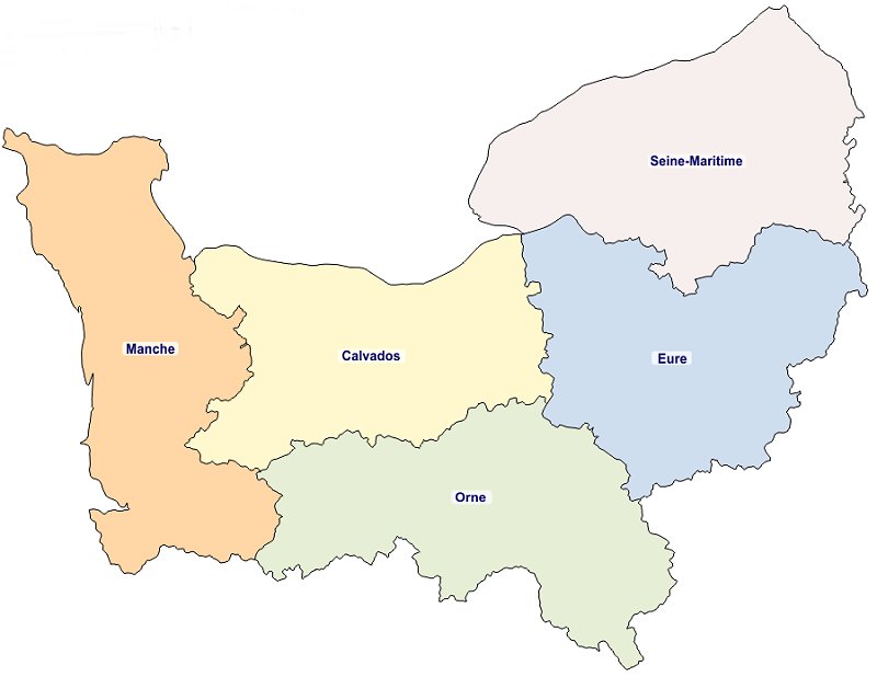
Normandy comprises mainland Normandy (a part of France) and the Channel Islands (mostly the British Crown Dependencies). It covers 30,627 square kilometres (11,825 sq mi). Its population is 3,499,280. The inhabitants of Normandy are known as Normans, and the region is the historic homeland of the Norman language. Large settlements include Rouen, Caen, Le Havre and Cherbourg.
The cultural region of Normandy is roughly similar to the historical Duchy of Normandy, which includes small areas now part of the departments of Mayenne and Sarthe. The Channel Islands are also historically part of Normandy; they cover 194 square kilometres (75 sq mi) and comprise two bailiwicks: Guernsey and Jersey, which are British Crown Dependencies.
Normandy's name comes from the settlement of the territory by Vikings ("Northmen") starting in the 9th century, and confirmed by treaty in the 10th century between King Charles III of France and the Viking jarl Rollo. For almost 150 years following the Norman conquest of England in 1066, Normandy and England were linked by having the same person reign as both Duke of Normandy and King of England.
The historical Duchy of Normandy was a formerly independent duchy occupying the lower Seine area, the Pays de Caux and the region to the west through the Pays d'Auge as far as the Cotentin Peninsula and Channel Islands.
Western Normandy belongs to the Armorican Massif, while most of the region lies in the Paris Basin. France's oldest rocks are exposed in Jobourg, on the Cotentin peninsula. The region is bounded to the north and west by the English Channel. There are granite cliffs in the west and limestone cliffs in the east. There are also long stretches of beach in the centre of the region. The bocage typical of the western areas caused problems for the invading forces in the Battle of Normandy. A notable feature of the landscape is created by the meanders of the Seine as it approaches its estuary.
Normandy is sparsely forested: 12.8% of the territory is wooded, compared to a French average of 23.6%, although the proportion varies between the departments. Eure has the most cover, at 21%, while Manche has the least, at 4%, a characteristic shared with the Channel Islands.
 Feel free to Email me any additions or corrections Feel free to Email me any additions or corrections
LINKS AVAILABLE TO YOUR SITE
| | |
