Reykjavík is the capital and largest city of Iceland. It is the world's northernmost capital of a sovereign state and a popular tourist destination. It is located in southwestern Iceland, on the southern shore of the Faxaflói Bay. With a population of around 120,000 (and over 200,000 in the Capital Region), it is the heart of Iceland's cultural, economic and governmental activity.
Reykjavík is believed to be the location of the first permanent settlement in Iceland, which Ingólfur Arnarson is said to have established around AD 870. Until the 18th century, there was no urban development in the city location. The city was founded in 1786 as an official trading town and grew steadily over the next decades, as it transformed into a regional and later national center of commerce, population, and governmental activities. It is among the cleanest, greenest, and safest cities in the world.
During the Ice Age (up to 10,000 years ago) a large glacier covered parts of the city area, reaching as far out as Álftanes. Other parts of the city area were covered by sea water. In the warm periods and at the end of the Ice Age, some hills like Öskjuhlíd were islands. The former sea level is indicated by sediments (with clams) reaching (at Öskjuhlíd, for example) as far as 43 m (141 ft) above the current sea level. The hills of Öskjuhlíd and Skólavörduholt appear to be the remains of former shield volcanoes which were active during the warm periods of the Ice Age.
After the Ice Age, the land rose as the heavy load of the glaciers fell away, and began to look as it does today.
The capital city area continued to be shaped by earthquakes and volcanic eruptions, like the one 4,500 years ago in the mountain range Bláfjöll, when the lava coming down the Ellidaá valley reached the sea at the bay of Ellidavogur.
The largest river to run through Reykjavík is the Ellidaá River, which is non-navigable. It is one of the best salmon fishing rivers in the country. Mount Esja, at 914 m (2,999 ft), is the highest mountain in the vicinity of Reykjavík.
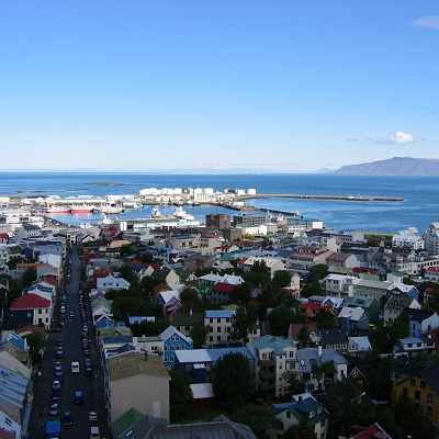
The city of Reykjavík is mostly located on the Seltjarnarnes peninsula, but the suburbs reach far out to the south and east. Reykjavík is a spread-out city: most of its urban area consists of low-density suburbs, and houses are usually widely spaced. The outer residential neighbourhoods are also widely spaced from each other; in between them are the main traffic arteries and a lot of empty space.
|