Ballycastle (from Irish: Baile an Chaistil, meaning "town of the castle") is a small town in County Antrim, Northern Ireland.
The town is located on the north-easternmost coastal tip of the island of Ireland at the northern mainland limit of the Antrim Coast and Glens Area of Outstanding Natural Beauty. Rathlin Island and the Mull of Kintyre in Scotland can be viewed from the coastline. The Ould Lammas Fair is held each year on the last Monday and Tuesday of August. Ballycastle is the home of the Corrymeela Community. It was the seat and main settlement of the old Moyle District Council and forms part of the North Antrim constituency.
Places of interest include:
- Fair Head, Ballycastle's headland rises 196 metres (643 ft) out of the bay. Goats can be seen roaming among the rocks beneath the cliff tops, where a walkway called 'The Gray Man's Path' winds around the rugged coastline. From the road, a man-made Iron Age island or crannog can be seen in the middle of a large lake.
- Knocklayde, a heather-covered mountain with a height of 1,695 feet, is crowned by Carn na Truagh (the cairn of sorrow), and provides extensive views over Ballycastle, Rathlin Island, Fair Head, and Scotland.
- Glentaisie, the most northerly of the Nine Glens of Antrim, lies at the foot of Knocklayde mountain. It is named after the Princess Taisie, the daughter of King Dorm of Rathlin Island. According to legend, Taisie, renowned for her great beauty, was betrothed to Congal, heir to the Kingdom of Ireland. The king of Norway also sought her hand in marriage, and when he arrived to claim his bride, her wedding celebrations to Congal had begun. The king and his army tried to capture Taisie, but in the subsequent battle he was killed, and his army fled leaderless and empty-handed.
- The Carey, Glenshesk and Tow Rivers flow down from the glens into the Margy River. It then flows into the Moyle Sea at the start of the Strand.
- The Strand's Ballycastle Beach is designated a Blue Flag beach.
- Pans Rocks, which are the remains of an iron salt pan lying at the far end of Ballycastle Beach, jut out into the sea providing a popular location for fishing.
- The Devils Churn, lying just beyond Pans Rocks, has steps carved into the stone leading to an underwater tunnel.
- Clare Park on Clare Road, was an estate owned by the then-local landed gentry, the McGildownys. The 17th-century house has been pulled down but it was set in a site high up on the Antrim coast.
- A cycling route runs from Ballycastle to Cushendun, by way of Torr Head, offering spectacular views and scenery. From the road above Torr Head, the whole of Moyle (the North Channel) can be seen. A popular spot for inshore sea fishing, Torr Head also boasts a coastguard station, which is notable in that it was built on and out of the remains of Dunvarragh, the fort of Barach.
- The Corrymeela Community (a Christian organisation promoting peace and reconciliation, founded in 1965) is based at Corrymeela, just outside Ballycastle.
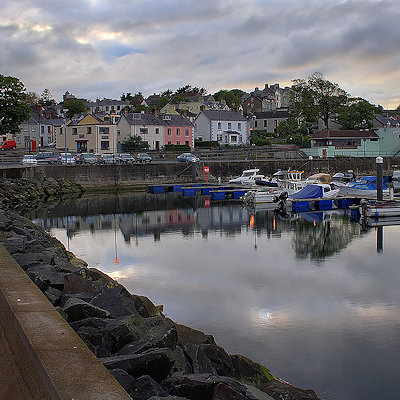
- Overlooking the harbour, there is a monument to Guglielmo Marconi whose employees made the world's first commercial wireless telegraph transmission between Ballycastle and the East Lighthouse on Rathlin Island.
|