The name Blairgowrie means "Plain of Gowrie" in Scottish Gaelic, in which language it is spelt Blar Ghobharaidh or Blàr Ghobhraidh. The name Rattray is Raitear in Gaelic, and may derive from an English language cognate of Gaelic rath meaning "fortress" plus a Pictish term cognate with Welsh tref meaning "settlement".
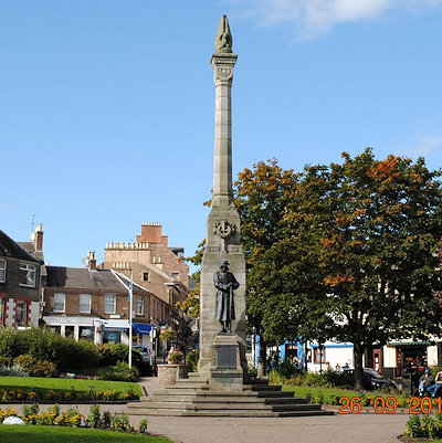
Blairgowrie and Rattray is a twin burgh in Perth and Kinross, Scotland. Amongst locals, the town is colloquially known simply as "Blair". Blairgowrie is the larger of the two former burghs which were united by an Act of Parliament in 1928 and lies on the south-west side of the River Ericht while Rattray is on the north-east side. Rattray claims to be the older and certainly Old Rattray, the area round Rattray Kirk, dates back to the 12th century. New Rattray, the area along the Boat Brae and Balmoral Road dates from 1777 when the River was spanned by the Brig o' Blair. The town lies on the north side of Strathmore at the foot of the Grampian Mountains. The west boundary is formed by the Knockie, a round grassy hill which is a popular walk and Craighall Gorge on the Ericht. Blairgowrie and Rattray developed over the centuries at the crossroads of several important historic routes with links from the town to Perth, Coupar Angus, Alyth and Braemar. The roads to Coupar Angus and Braemar form part of General Wade's military road from Perth to Fort George. The town's main feature and centrepiece is the Wellmeadow, a grassy triangle in the middle of town which hosts regular markets and outdoor entertainment.
Following the restoration of city status on Perth in 2012, Blairgowrie and Rattray has become the largest town in Perthshire.
The area around Blairgowrie has been occupied continuously since the Neolithic, as evidenced from the Cleaven Dyke, a cursus monument 2 miles SSW of the town, as well as a Neolithic long mortuary enclosure 4 miles WSW at Inchtuthil. Several stone circles of this age can also be found in the area, notably the circle bisected by the road at Leys of Marlee, 1 mile to the west of Blairgowrie.
Numerous Neolithic and Bronze Age artifacts have been found in the immediate area, including a number of flint arrowheads, spearheads, knives and scrapers found at Carsie, half a mile to the south of Blairgowrie, and which are now displayed at Perth Museum, and bronze axes, and a bronze sword now in Kelvingrove Museum, Glasgow.
The remains of a Roman legionary fort can be found 4 miles WSW of Blairgowrie at Inchtuthil, dating from the decade 80-90. Unencumbered by subsequent development, this is considered to be one of the most important archaeological sites in Britain.
Pictish remains are in abundance in this part of Scotland and one of the largest collections of Pictish sculptured stones is housed 5 miles to the East of the town at the Meigle Sculptured Stone Museum. The size of the collection, all of which were found in Meigle, suggests this was an ecclesiastical centre of some importance in the 8th to 10th centuries.
From around 1600 to the turn of the 19th century, Blairgowrie had a fairly stable population, recorded at 425 inhabitants at in the first Statistical Account in 1792. in the second Statistical Account of 1853 notes a disproportionate increase due to an influx of families attracted by the expanding textiles industry Gaelic was declining but still partially spoken in the upper part of the parish at that time, with all speaking English.
Blairgowrie was made a barony in favour of George Drummond of Blair in 1634 by a royal charter of Charles I, and became a free burgh in 1809. In 1724 the military road from Coupar Angus to Fort George which passes through the town on the line of the A923 and A93 was completed.
The town expanded hugely in the 19th century thanks to the employment provided by the many textile mills which were built along the River Ericht, all now closed. By 1870 there were 12 mills along the river employing nearly 2000 men and women and the population had increased from 400 in the 1700s to 4000. Some of the disused mill buildings can be seen from the riverside walk west from the bridge and from Haugh Road to the east . Keithbank Mill has been converted to apartments.
Soft fruit growing, mainly raspberries and strawberries developed in the 20th century and became a very important part of the town's economy with Smedleys opening a cannery in Haugh Road, Adamsons a jam factory in Croft Lane and huge quantities of table berries and pulp being despatched to markets and jam factories throughout Britain. Berry pickers were brought in by bus from Perth and Dundee, and large encampments were set up on farms for pickers from further afield, mainly from the Glasgow area, who made this their annual holiday. They were joined by the travelling community who congregated here for the berry season. One of the best examples was the Tin City at Essendy, which housed workers in a complex of tin huts with its own chapel, post office, shop, kitchens, etc.
The coming of the railway revolutionised the textile and soft fruit trade, but the last train ran in the 1960s, and the extensive railway yards are now the site of the Tesco supermarket and Welton Road industrial estate.
Blairgowrie had a busy livestock market at the bottom of the Boat Brae but this closed in the 1960s and is now the site of the Ashgrove Court sheltered housing complex.
A short distance upstream from the bridge on the riverside path is Cargill's Leap, a historic site where Donald Cargill, a minister and covenanter, escaped Government troops by jumping over the rocky gorge of the River Ericht.
Just outside the Rattray boundary on the A93 is Craighall Castle, the ancestral home of the chieftain of the Clan Rattray. The castle occupies a dominating position on the edge of the gorge above the river but unfortunately is no longer occupied by a Rattray, having been sold in 2010.
Newton Castle, home to the current chieftain of the Clan Macpherson, Sir William Macpherson, and Ardblair Castle, home to the Blair Oliphant family, both have Jacobite history and according to legend are connected by a secret tunnel.