
Like us on Facebook
PLACE NAMES


|
|
Dnipropetrovsk
|
| |
|
The city is built mainly upon both banks of the Dnieper, at its confluence with the Samara River. In the loop of a major meander, the Dnieper changes its course from the north west to continue southerly and later south-westerly through Ukraine, ultimately passing Kherson, where it finally flows into the Black Sea.
Nowadays both the north and south banks play home to a range of industrial enterprises and manufacturing plants. The airport is located about 15 km (9.3 mi) south-east of the city.
The centre of the city is constructed on the right bank which is part of the Dnieper Upland, while the left bank is part of the Dnieper Lowland. The old town is situated atop a hill that is formed as a result of the river's change of course to the south. The change of river's direction is caused by its proximity to the Azov Upland located southeast of the city.
One of the city's streets, Akademik Yavornitskyi Prospekt, links the two major architectural ensembles of the city and constitutes an important thoroughfare through the centre, which along with various suburban radial road systems, provides some of the area's most vital transport links for both suburban and inter-urban travel.
The city has a variety of theatres (plus an Opera) and museums of interest to tourists, including the Dmytro Yavornytsky National Historical Museum. There are also several parks, restaurants and beaches.
The major streets of the city were renamed in honour of Marxist heroes during the Soviet era. Following the 2015 law on decommunization these have been renamed.
The central thoroughfare is known as Akademik Yavornytskyi Prospekt, a, wide and long boulevard that stretches east to west through the centre of the city. It was founded in the 18th century and parts of its buildings are the actual decoration of the city. In the heart of the city is Soborna Square, which includes the majestic cathedral founded by order of Catherine the Great in 1787.
On the square, there are some remarkable buildings: the Museum of History, Diorama "Battle for the Dnieper River (World War II)", and also the park in which one can rest in the hot summer. Walking down the hill to the Dnieper River, one arrives in the large Taras Shevchenko Park (which is on the right bank of the river) and on Monastyrsky Island. This island is one of the most interesting places in the city. In the 9th century, the Byzantine monks based a monastery here.
A few areas retain their historical character: all of Central Avenue, some street-blocks on the main hill (the Nagorna part) between Pushkin Prospekt and Embankment, and sections near Globa (formerly known as Chkalov park until it was recently renamed) and Shevchenko parks have been untouched for 150 years.
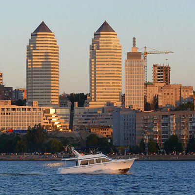
The Dnieper River keeps the climate mild. It is visible from many points in Dnipro. From any of the three hills in the city, one can see a view of the river, islands, parks, outskirts, river banks and other hills.
There was no need to build skyscrapers in the city in Soviet times. The major industries preferred to locate their offices close to their factories and away from the centre of town. Most new office buildings are built in the same architectural style as the old buildings. A number, however, display more modern aesthetics, and some blend the two styles.
|
 Feel free to Email me any additions or corrections Feel free to Email me any additions or corrections
LINKS AVAILABLE TO YOUR SITE
|
|

