
Like us on Facebook
PLACE NAMES


|
| Vanadzor |
 |
|
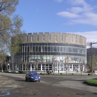
Vanadzor formerly called Kirovakan is an urban municipal community and the third largest city in Armenia, serving as the capital of Lori Province in the northern part of the country. It is located about 128 kilometres (80 miles) north of the capital Yerevan. As of the 2011 census, the city had a population of 86,199, down from 148,876 reported at the 1979 official census. Currently, the town has a population of approximately 76,000. Vanadzor is the seat of the Diocese of Gougark of the Armenian Apostolic Church.
In the official records of the Russian Empire, the city was labelled as Karaklis Bolshoy, lit. 'Greater Karakilisa'). Following the Sovietization of Armenia, the city was renamed Martunashen (???????????, alternatively Martunakan) in 1926 after Armenian Bolshevik revolutionary Alexander Miasnikian. On 3 January 1935, it was renamed Kirovakan, after the popular Russian Bolshevik leader Sergey Kirov. A close associate of Miasnikian and Aghasi Khanjian, Kirov had been assassinated on December 1 of the previous year. On 25 June 1992, after Armenia gained its independence, Kirovakan was renamed back to its initial name Vanadzor after the Vanadzor River which flows through the city. The name Vanadzor is composed of the Armenian words vank, ("monastery") and dzor ("valley"). Thus, the name of the city means "valley of the monastery."
The area of present-day Vanadzor has been settled since the Bronze Age, based on the tombs and other historic remains found on the nearby hills of Tagavoranist and Mashtots. In antiquity, the area fell into the canton of Tashir of Gugark, the 13th province of the Kingdom of Armenia. Later, the region was ruled by the other Armenian dynasties of the Arsacids and the Bagratunis. The area was part of the Kingdom of Lori from the 10th century until the beginning of the 12th century. With the invasion of the Seljuk Turks, the region came under the rule of the Seljuk Empire. The settlement was called Gharakilisa (meaning black church in Turkic) by the Seljuks possibly as early as the 13th century, the name being taken from the black-stoned Armenian church of the Holy Mother of God on a nearby hill.
In 1801, the entire region of Lori became part of the Russian Empire along with the Georgian state. Lori was a strategically important territory for the Russian defensive forces on the border against Persia. In 1826, the settlement of Gharakilisa was entirely destroyed by Hasan Khan during the Russo-Persian war. In 1828, the Russians founded a new town as a major centre for the deployment of their troops during the Russo-Turkish War of 1828–29. According to Khachatur Abovian, the population of Gharakilisa was not more than 600 by the end of the 1820s, mainly consisting of migrants from Yerevan. In 1849, it became part of the Erivan Governorate within the Russian Empire. Under its new administrative status, Gharakilisa was flooded with many hundreds of migrating Armenian families from Kars, Ardahan and the Western Armenian cities of Karin (Erzurum) and Daroynk (Dogubeyazit).
The town enjoyed a considerable uplift through the opening of the railroad towards Tbilisi in 1899. The vicinity of the town was the site of the Battle of Karakilisa in May 1918, when General Tovmas Nazarbekian's outnumbered troops, led by Garegin Nzhdeh successfully defended the region against the invading Ottoman Army, pushed them back just a few days after the crucial Armenian victory in the Battle of Sardarapat, thus allowing the Republic of Armenia to come into existence. On the North side of the Spitak-Vanadzor highway, about 2 km (1 mi) west of the city, there is a little shrine in the ruins of a church, the site of a planned monument to that battle.
In 1920, after only 2 years of independence, Armenia fell under Soviet rule. The first city development plan for Gharakilisa, initiated by architects Karo Halabyan, Mikayel Mazmanyan and Gevork Kochar, was adopted in 1929–1930. Under the new plan, the town was enlarged towards the East and the West. In 1935, the Soviets renamed the city Kirovakan after the Bolshevik leader Sergey Kirov. In 1939, a new remodeling plan for the city, created by architects N. Zargaryan and A. Minasyan, was introduced to create an industrial district and a summer-resort area. The centre of the city was redeveloped during the 1950s. The central town square named after Sergey Kirov (now Hayk Square) was constructed along with the surrounding government and administrative buildings. After Armenia gained its independence, Kirovakan was renamed Vanadzor after the Vanadzor River that flows through the city.
Vanadzor, along with Gyumri and Spitak (25 km (16 mi) west), suffered a considerable amount of damage from the 1988 earthquake when 564 residents died in the city. Unlike the two other cities, the majority of buildings in Vanadzor were unscathed from the earthquake.
|
 Feel free to Email me any additions or corrections Feel free to Email me any additions or corrections
LINKS AVAILABLE TO YOUR SITE
| |
