
Like us on Facebook
PLACE NAMES


|
|
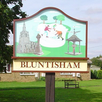
Bluntisham
|
| |
Bluntisham is a village and civil parish in Cambridgeshire, England. The population of the civil parish at the 2011 census was 2,003. Bluntisham lies approximately 8 miles (13 km) east of Huntingdon. Bluntisham is situated within Huntingdonshire which is a non-metropolitan district of Cambridgeshire as well as being a historic county of England. The villages of Earith, Colne, Woodhurst, and Somersham are all close by. The prime meridian passes through the western edge of Bluntisham.
The village was known as Bluntersham between the 10th and 13th centuries, Blondesham in the 14th century, and Bluntysham, Bluntsome and Blunsham in the 16th century. Due to the close proximity of Bluntisham and Earith, the two formed the parish of Bluntisham-cum-Earith, with the parish church in Bluntisham and a chapelry in Earith. However, the civil parish of Bluntisham-cum-Earith was dissolved in 1948 when the two were separated.
There is evidence to suggest that Neolithic and Roman inhabitants once settled in Bluntisham. The manor of Bluntisham goes back to the early part of the 10th century, when it was seized by Toli the Dane, who is said to have been the jarl or alderman of Huntingdon. Toli was killed at the Battle of Tempsford in 917, at which point the county returned to the rule of Edward the Elder. Bluntisham later became the property of Wulfnoth Cild who sold it circa 970–75 to Bishop Æthelwold of Winchester and Brithnoth, the first Abbot of Ely, for the endowment of Ely Abbey. The sale was confirmed by King Edgar, but when he died in 975 a claim was made by the sons of Bogo de Hemingford, who believed that it was the inheritance of their uncle. Their claim was declared false at the county court, and the sale to Ely Abbey went ahead.
In 1085 William the Conqueror ordered that a survey should be carried out across his kingdom to discover who owned which parts and what it was worth. The survey took place in 1086 and the results were recorded in what, since the 12th century, has become known as the Domesday Book. Starting with the king himself, for each landholder within a county there is a list of their estates or manors; and, for each manor, there is a summary of the resources of the manor, the amount of annual rent that was collected by the lord of the manor both in 1066 and in 1086, together with the taxable value.
Bluntisham was listed in the Domesday Book in the Hundred of Hurstingstone in Huntingdonshire; the name of the settlement was written as Bluntesham in the Domesday Book.
The Domesday Book does not explicitly detail the population of a place but it records that there was 16 households at Bluntisham. There is no consensus about the average size of a household at that time; estimates range from 3.5 to 5.0 people per household. Using these figures then an estimate of the population of Bluntisham in 1086 is that it was within the range of 56 and 80 people.
The Domesday Book uses a number of units of measure for areas of land that are now unfamiliar terms, such as hides and ploughlands. In different parts of the country, these were terms for the area of land that a team of eight oxen could plough in a single season and are equivalent to 120 acres (49 hectares); this was the amount of land that was considered to be sufficient to support a single family. By 1086, the hide had become a unit of tax assessment rather than an actual land area. The survey records that there was 6 ploughlands at Bluntisham in 1086 and that there was the capacity for a further 2.62 ploughlands. In addition to the arable land, there was 20 acres (8 hectares) of meadows and 194 acres (79 hectares) of woodland at Bluntisham.
The tax assessment in the Domesday Book was known as geld or danegeld and was a type of land-tax based on the hide or ploughland. It was originally a way of collecting a tribute to pay off the Danes when they attacked England, and was only levied when necessary. Following the Norman Conquest, the geld was used to raise money for the King and to pay for continental wars; by 1130, the geld was being collected annually. Having determined the value of a manor's land and other assets, a tax of so many shillings and pence per pound of value would be levied on the land holder. While this was typically two shillings in the pound the amount did vary; for example, in 1084 it was as high as six shillings in the pound. For the manors at Bluntisham the total tax assessed was seven geld.
By 1086 there was already a church and a priest at Bluntisham.
Bluntisham remained under ownership of the Bishop of Ely until the dissolution of the monasteries, when it was granted to the dean and chapter of Ely. Valentine Walton was appointed governor of Ely in 1649 for his services to Oliver Cromwell's Parliament. Upon the Restoration, it was restored to the dean and chapter. In 1869, it was taken over by the Ecclesiastical Commissioners, who remain lords of the manor.
The village was built up around four fields. The north-western part of the parish contains Higham Field, with Gull Field (named for the gills which slope towards the Great Ouse) to the south-west. Colneway Field lay to the north-east of Higham Field, with Old Mill (or "Inhams") Field located between Colneway and Bury Fen, stretching to Earith. A large wood known as "Bluntisham Hangar" once existed south of Highams Field, and is probably that mentioned in the Domesday Book. In 1341 the wood was recorded as the boundary of the Bishop of Ely's right of hunting. Bluntisham's woodland declined from 68 acres (28 ha) in 1843 to 10 acres (4.0 ha) by 1925.
The Old Rectory, now known as Bluntisham House, was built circa 1720, with wings added in the 18th century and further alterations in the 19th century. The doorway was taken from the Old Slepe Hall in St Ives, the former home of Oliver Cromwell. The building, once the childhood home of the writer Dorothy L. Sayers, has a Grade II listing.
|
 Feel free to Email me any additions or corrections Feel free to Email me any additions or corrections
LINKS AVAILABLE TO YOUR SITE
| |
