Like us on Facebook
PLACE NAMES


|
|
Kington
|

| |
|
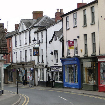
Kington is 2.0 miles (3.2 km) from the border with Wales and, despite being on the western side of Offa's Dyke, has been English for over a thousand years. The town is in the shadow of Hergest Ridge, and on the River Arrow, where it is crossed by the A44 road. It is 19 miles (31 km) north-west of Hereford, the county town. Nearby towns include Presteigne, Builth Wells, Knighton and Leominster. The centre of the town is situated at 159 metres (522 ft) above sea level. The civil parish covers an area of 347 hectares (860 acres).
Kington may have derived from King's-ton, being Anglo-Saxon for "King's Town", similar to other nearby towns such as Presteigne meaning "Priest's Town" and Knighton being "Knight's Town".
Kington is to the west of Offa's Dyke so presumably this land was Welsh in the 8th century AD. The land was held by Anglo-Saxons in 1066, but devastated. After the Norman Conquest Kington then passed to the Crown on the downfall of Roger de Breteuil, 2nd Earl of Hereford in 1075. Before 1121 King Henry I gave Kington to Adam de Port, who founded a new Marcher barony in this part of the early Welsh Marches.
Kington seems to have been[citation needed] a quiet barony and was associated with the office of sheriff of Hereford. In 1172, Adam de Port, probably the great-grandson of Henry Port, rebelled and fled the country. He returned in 1174 with a Scottish army, only to flee from the resulting Battle of Alnwick to the great mirth of the Norman court. With this his barony of Kington was taken by the Crown and became an appurtenance of the office of Sheriff of Hereford, finally being granted to William de Braose, 4th Lord of Bramber in 1203 for £100. The castle then saw action in the Braose Wars against King John of England and was probably destroyed by royal forces in August 1216. Within a few years a new fortress was commenced at nearby Huntington Castle and Kington Castle was abandoned. All that remains of Kington Castle today is a great outcrop of rock topped by a few fragmentary earthworks. The old town clustered around the castle and Norman church on top of a defensive hill above the River Arrow.
'Chingtune' was recorded in the Domesday Book in 1086, the name meaning Kings Town or Manor, high on the hill above the town where St. Mary's Church now stands. The new Kington, called Kyneton in the Fields, was laid out between 1175 and 1230 on land bordering the River Arrow and possibly designated as part of the Saxon open field system.
Situated on the direct route the drovers took from Hergest Ridge and with eight annual fairs, Kington grew in importance as a market town and there is still a thriving livestock market on Thursdays. The town retains the medieval grid pattern of streets and back lanes.
In the chapel of St. Mary's Church, there is the alabaster tomb of Sir Thomas Vaughan of nearby Hergest Court, slain at the Battle of Banbury 1469, and his wife, Elen Gethin. The ghost of Sir Thomas, and also that of the Black Dog of Hergest are said to haunt the area around Hergest Ridge. The Black Dog's sighting reputedly presages death. It is also rumoured to have been the prototype for The Hound of the Baskervilles as Conan Doyle is known to have stayed at nearby Hergest Hall shortly before he wrote the novel.
|
 Feel free to Email me any additions or corrections Feel free to Email me any additions or corrections
LINKS AVAILABLE TO YOUR SITE
| |


