Like us on Facebook
PLACE NAMES


|
|
Caterham
|

|
|
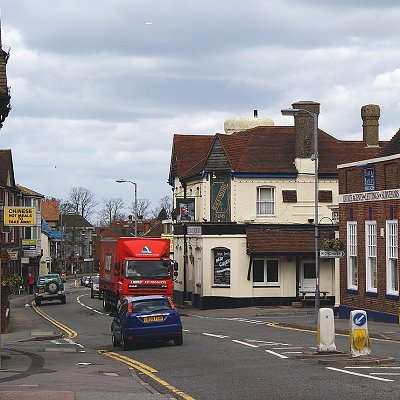
Caterham is a town in the Tandridge District. The town is administratively divided into two: Caterham on the Hill, and Caterham Valley, which includes the main town centre in the middle of a dry valley but rises to equal heights to the south. The town lies close to the A22, 21 miles (34 kilometres) from Guildford and 6 miles (10 kilometres) south of Croydon, in an upper valley cleft into the dip slope of the North Downs. Caterham on the Hill is above the valley to the west.
An encampment on the top of White Hill, in Caterham Valley south of Caterham School, between Bletchingley and the town centre is called The Cardinal's Cap which was excavated and inspected in designating it a Scheduled Ancient Monument. With close ramparts forming two or more lines, archaeologists describe the fort as a "large multivallate hillfort at War Coppice Camp".
Its inner bank is about 0.5m wide and 0.4m high with a ditch 7m wide and 0.3m deep situated 2m below its crest. To the west of the ditch is the second bank, 8m wide and 0.5m high. Beyond this the second ditch has become completely infilled over the years but survives as a buried feature approximately 8m wide, visible as a terrace. Traces of a second, slighter terrace are situated further down the slope, representing evidence of additional scarping. The defences to the north east include an inner bank 5m wide and up to 0.5m high from the interior and 4m high from the exterior with a surrounding ditch 8m wide and 0.6m deep. Beyond this is a counterscarp bank 6m wide and up to 1m high. A 35m long section of a second ditch, which has become partially infilled over the years, survives 25m further out to the north east. In the southern and south eastern areas of the monument, sections of the hillfort have been disturbed by later quarrying activity. Although the monument was originally thought to be either Roman or Neolithic in date, excavations in 1950 showed it to be Iron Age and what had previously been thought to be a fragment of an earthwork was almost complete with the banks of the ramparts having been palisaded and revetted to strengthen their defence.
The town lies within the Anglo-Saxon feudal division of Tandridge hundred.
The North Downs Way, a National trail popular with walkers, passes very close to the town and is readily accessible from either Harestone Valley Road or Tupwood Lane, the Celtic hillfort promontory of the Downs mentioned above, The Cardinal's Cap, and Fosterdown or Pilgrims' Fort, a London Defensive Fort at the top of part of the ridge forming Godstone Hill, in Caterham Valley.
|
 Feel free to Email me any additions or corrections Feel free to Email me any additions or corrections
LINKS AVAILABLE TO YOUR SITE
| |


