
Like us on Facebook
PLACE NAMES


|
|
Penafiel
|
|
|
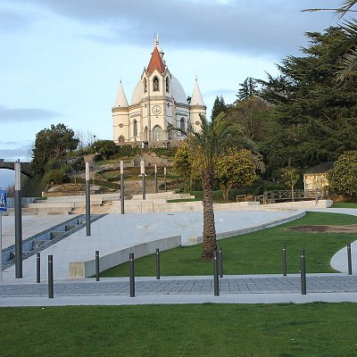
Penafiel is a municipality and former bishopric (now a Latin Catholic titular see) in the northern Portuguese district of Porto. Capital of the Tâmega Subregion, the population was 72,265 in 2011, in an area of 212.24 square kilometres (81.95 sq mi).
The municipality extends within an area of 212.2 square kilometres (81.9 sq mi), in a confluence of river valleys marked by the Douro, Tâmega and Sousa Rivers, connecting the littoral region and the Transmontana zone. It is a landscape of deep valleys, with intense irrigated zones and pasturelands, with fields encircled by forests of pine and eucalyptus. This inter-fluvial region have granite soils and is rich in water resources, permitting intensive agriculture and extraction industries. The southwest extension of the municipality include a complex of Schist and Greywacke geology, resulting in mountainous, uncultivated and largely forest lands.
An intermediary zone, dividing the littoral and mountainous regions, the region was an important transitory point, with lines of communication extending along inter-regional, land and fluvial networks. The first example was the "royal roadways" that date to the medieval period, that connect Porto and the Trás-os-Montes, that resulted the development of the urban centre, that was a fulcrum in supporting transiting peoples and goods. The Douro was an important link and penetrated the interior, while the flanks of the Alto Douro were used to produce vineyards. The "Entre-os-Rios" district was also an important part in supporting travel along the interior.
 Feel free to Email me any additions or corrections Feel free to Email me any additions or corrections
LINKS AVAILABLE TO YOUR SITE
| | |
