Aylesbury is the county town of Buckinghamshire, England and administrative town of the Aylesbury Vale district in the outskirts of the London commuter belt. Its urban area in 2011 includes Bierton, Fairford Leys, Stoke Mandeville and Watermead and had an overall population of 74,748 whereas the town, a civil parish and town council had in 2011 a population of 58,740.
Aylesbury falls into for some European statistical purposes a notional geographical region known as the South Midlands that encompasses the north of the South East, and the southern extremities of the East Midlands, and the western portion of the East of England. In the 2001 census the Aylesbury Urban Area had 69,021 inhabitants by the 2011 census the urban area's population had grown to 74,748.
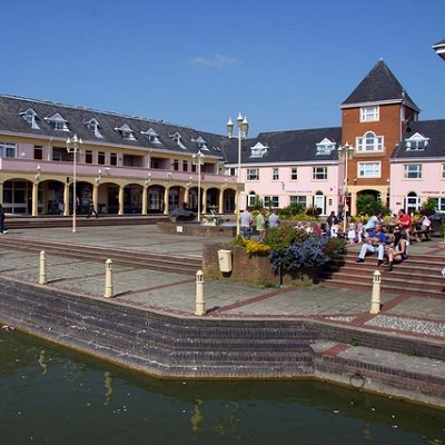
Housing estates in or neighbourhoods of the modern Aylesbury include: Bedgrove, Broughton, Elm Farm, Elmhurst, Fairford Leys, Haydon Hill, Hawkslade Farm, Meadowcroft, Prebendal Farm, Quarrendon, Queens Park, Southcourt, Stoke Grange, Walton Court, Watermead and the Willows. Aylesbury has also been extended to completely surround the former hamlets or farms at Bedgrove, California, New Zealand, Prebendal Farm, Quarrendon, Turnfurlong and Walton.
If plans are approved to increase expected new housing capacity add as expected twenty thousand people, suburban Aylesbury could become largely or wholly contiguous with the neighbouring villages of Bierton, Hartwell, Stoke Mandeville, Stone, Sedrup and Weston Turville. Distinct whole areas that have a notably high property price in the town are Bedgrove, the conservation area around St. Mary's church and Queens Park, particularly facing onto the canal. Anticipated developments are expected to raise the urban population of Aylesbury from its current approximation of 75,000 to 100,000 between 2018 and 2023. London is centred 36.5 miles (58.7 km) southeast, over the Chilterns.
Originally, it was "Aegel's Burg". There was a burg or hill fort here since Roman times.
|