
Like us on Facebook
PLACE NAMES


|
|
Whitstable
|
| |
|
Whitstable is a seaside town in northeast Kent. It is approximately 8 kilometres (5 mi) north of the city of Canterbury and approximately 3 kilometres (2 mi) west of the seaside town of Herne Bay. It is part of the City of Canterbury district and has a population of about 30,000.The town was first recorded in the Domesday Book of 1086, under the name Witenestaple, meaning "the meeting place of the white post", which referred to a local landmark.
Known as the "Pearl of Kent", Whitstable is famous for its oysters, which have been collected in the area since at least Roman times. The town itself dates back to before the writing of the Domesday Book. Whitstable's distinctive character is popular with tourists, and its maritime heritage is celebrated with the annual oyster festival. Freshly caught shellfish are available throughout the year at several seafood restaurants and pubs in the town.
In 1830 one of the earliest passenger railway services was opened by the Canterbury and Whitstable Railway Company, and in 1832 the company opened Whitstable harbour and extended the line to enable passage to London from the port. The railway has since closed but the harbour still plays an important role in the town's economy.
Archaeological finds indicate that the Whitstable area was inhabited during the Palaeolithic era, the Bronze Age and the Iron Age. Oysters were harvested in the area in Roman times. The remains of a Roman building have been found in the centre of the town. Charters indicate that there were Saxon settlements where salt production and coastal trade occurred. At that time, Witenestaple was an administrative area which stretched from the coast to the village of Blean, 3 kilometres (2 mi) north of Canterbury. The area contained three manors at Seasalter, Northwood and Swalecliffe. The Seasalter and Swalecliffe manors were owned by the church, and the manor at Northwood was run by noblemen on behalf of the king. Fisheries were located at the Seasalter manor, saltworks were at the Northwood manor, and pigs were farmed at the forest in Blean. By 1226, the name of the area had evolved into Whitstaple. Saltworks were opened at the Seasalter manor around the turn of the 14th century, and a sea wall was built there in 1325 to prevent coastal flooding.
By 1413, the three manors had combined to form the Whitstaple manor, and had been sold to a religious foundation in Essex. The manor was seized by King Henry VIII during his suppression of the church in the 1500s, and was given back to the nobility. A Royal Patent was granted in 1574 to the manor owner for the fishing of its oyster beds, and in the same year, the lands at Tankerton were incorporated into the manor. A copperas works was established at Tankerton in 1588, which operated until about 1830. By 1610, the name Whitstaple had become Whitstable.
Around the mid-1700s, goods and passengers began to be transported by ship between London and Whitstable, and a toll road was built to the cathedral city of Canterbury. These improvements in transport led to the town's development as a seaside resort; the first advertisements for bathing machines at Whitstable appeared in 1768. In 1790 the manor was sold to private landowners, and three years later the rights to harvest the oyster beds were bought by the newly established Oyster Company of Free Fishers and Dredgers.
On 3 May 1830, the world's first steam-hauled passenger and freight railway service was opened by the Canterbury and Whitstable Railway Company. Designed by William James, the line ran six miles (10 km) from Westgate in Canterbury to Whitstable town centre. The railway line's initials—C&WR—and Whitstable's shellfish industry eventually led to its nickname, the Crab And Winkle Railway. Trains were drven by a locomotive for part of the journey, but on inclined planes were pulled on ropes by steam-driven stationary winding engines located at Tyler Hill and Clowes Wood. The locomotive used was the Invicta, an 0-4-0 inclined cylinder tender locomotive built by Robert Stephenson, the son of engineer George Stephenson. Whitstable harbour was opened by the railway company in 1832, and the rail line was extended to enable goods, mainly coal, to be directly transferred from ships onto the trains. In 1834, the world's first season tickets were issued for the C&WR line.
The Invicta locomotive was retired in 1840 and replaced by horses until a third winding engine was built at South Street. The Invicta was kept for scrap, but in 1898 work began on its restoration, which continued intermittently until its completion in 1977 by the National Railway Museum in York. On 3 May 1980 the locomotive was returned to Canterbury to celebrate the 150th anniversary of the line.
In 1845, the Canterbury and Whitstable Railway Company was bought by the South Eastern Railway, who introduced steam locomotives capable of operating along the entire length of the railway. A direct rail route from Whitstable to London was established in 1860 when the London, Chatham and Dover Railway opened a station on what is now the Chatham Main Line. On 16 November 1869, 71 buildings in the town were destroyed by a fire started at a shop near the harbour. In about 1856 the first branch of the Sea Cadet Corps, then known as the Naval Lads' Brigade, was established in the town by the Reverend Henry Barton.
A plant to manufacture tarmacadam was built beside Whitstable Harbour in 1936. The harbour gradually fell into decay after the Second World War II, but in 1958 the Whitstable Urban District Council purchased and repaired the harbour with the intention of rejuvenating the town's economy. By the early 20th century, the Oyster Company of Free Fishers and Dredgers had become the Whitstable Oyster Fishery Company. Oyster production drastically declined between the 1940s and 1970s due to pollution, disease, bad weather and underinvestment, although there has since been a gradual improvement. The Crab and Winkle Line finally closed in 1953, but about a third of the line was reopened as a footpath and cycleway in 1999 under the stewardship of a local charity, the Crab and Winkle Line Trust. One of the main developments to the town in recent years was the Horsebridge project. Completed in 2005, it was designed to regenerate a dilapidated area of the town with the construction of new shops and houses, a town square, and a community centre with a performance space and art gallery.
Whitstable is located on the northeast Kent coast. The town lies to the east of the outlet of The Swale into the Thames Estuary. The town is 3 kilometres (2 mi) west of the seaside town of Herne Bay, 8 kilometres (5 mi) northeast of the town of Faversham and 8 kilometres (5 mi) north of the city of Canterbury; several small villages lie in between. The suburbs/villages of Tankerton, Swalecliffe and Chestfield are at the eastern end of the town, Seasalter at the west, and South Street at the south. Chestfield has its own parish council. An area of protected woodland and grassland called Duncan Down lies to the southeast.
The longest established event is the Regatta dating from a sailing contest between 26 boats from Whitstable and Faversham split into 3 classes (divisions) in 1792. A reporter at the scene wrote:- “Much nautical skill was displayed in the maneuvering of the various squadrons. Every hoy, smack, wherry etc. in the vicinity of Whitstable was crowded with company and formed quite a fair upon the ocean”. In addition, at least two of the spectating boats had bands aboard and tents were erected along the shore which was lined with spectators.
The Regatta continued to become the biggest event on the North Kent Coast in the 19th century. It has moved from the original Whitstable to Tankerton for more land based events with fairground and fireworks on the elevated Slopes. For many years run by the Council , the Whitstable and Herne Bay Lions Club have taken it on in the last 31 years. Future events will be more sea borne with yachting and rowing, and plans for swimming and even the traditional greasy pole. The 2010 Regatta will be on Saturday 31 July and Sunday 1 August.
May Day is celebrated with the annual Jack-in-the-Green parade, with traditional English dancing throughout the town, a fair at Whitstable Castle and a maypole dance by local schoolchildren overlooking the sea. It has been run by Whitstable and Herne Bay Lions Club for 34 years.
The importance of oysters to the tradition of Whitstable is celebrated with the Oyster Festival in July each year. The nine-day festival starts with an opening parade on the nearest Saturday to St James' Day. The parade starts with the official "Landing of the Catch", followed by the procession of the oysters in a horse-drawn dray through the town, stopping to deliver the catch to local restaurants, cafes and public houses. The rest of the festival consists of entertainment for both adults and children, with local art on display around the town, and many establishments offering local fish dishes.
The Whitstable Museum and Gallery displays artifacts and portraits relating to the town's seafaring traditions, with special features on oysters, diving and shipping. In 2001, the Museum was awarded the international Nautiek Award for services to diving history. The town's main theatre is the Playhouse which is owned by theatrical group, the Lindley Players. The theatre is hired out to other groups such as the amateur Phoenix Theatre Group and the professional Playtime Theatre Company. The Horsebridge Arts and Community Centre opened in March 2004 as part of the Horsebridge redevelopment. Built with an "upturned boat" design, and three floors totalling 900 square metres (9,700 sq ft), the centre contains an art gallery, a performance space, art workshops, a learning area, and conference rooms.
Tankerton coast from a distance of roughly 100 metres. The shingle/sandy beach is interspersed with groynes and lined with up to three rows of variously coloured beach huts. Houses overlook the beach from the higher ground behind.
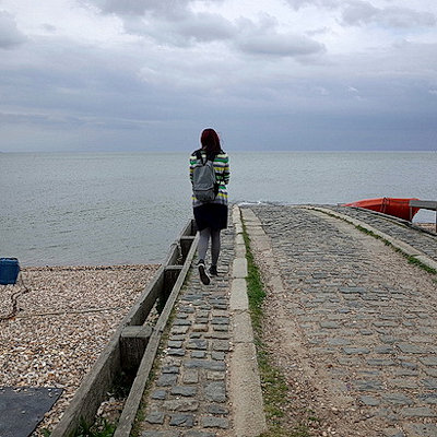
The town has shingle/sandy beaches flanking the harbour, where sunbathing, swimming and water sports are popular. A notable feature of Whitstable is The Street, a natural strip of shingle on clay bank which runs out to sea at right angles to the coast, for a distance of about half a mile. It is the last remnant of the land to the north of the town lost to sea erosion over millennia. Located to the east of the harbour, The Street is revealed only at low tide, when it is possible to walk out along it as well as swim either side in safe, sandy bottomed shallows.[49] A view of The Street can be seen on the hilltop lawns of Tankerton Slopes. The Slopes are home to the largest population in England of the rare Hog’s Fennel.
Whitstable Castle is situated on the border of Whitstable and the suburb of Tankerton. It was originally built as an octagonal tower in 1789 by Charles Pearson, the owner of a copperas company in the town and a future investor in the Canterbury and Whitstable Railway. However, Pearson later added to the building, developing it into a manor house. In 1836 the house, then known as Tankerton Tower, was bought by London businessman Wynn Ellis, who by 1842 had added a west wing, a bell tower and a lodge. The building had become known as Tankerton Castle by 1897, although it is now commonly referred to as Whistable Castle. Now managed by the Whitstable Castle Trust, the castle grounds is the only public park in the town and is a centre for community activity.
Off the coast of Whitstable is a windfarm, consisting of 30 wind turbines, each 140 metres (459 ft) high, providing enough electricity to power 70,000 households. A now-redundant offshore World War II sea fort is visible from the town's coast. Sailing trips are available from the harbour to the windfarm, the sea fort and a seal watching spot in the Thames Estuary.
Island Wall, the closest street to the seafront, has numerous buildings dating from the mid-19th century including the Neptune and Wall Tavern pubs, and the Dollar Row cottages, which were built from the proceeds of a salvage operation on a ship carrying silver dollars. The street is home to the Favourite, one of the few remaining Whitstable oyster yawls. Built in 1890, it is now managed by the Favourite Trust, a charitable trust who undertake fund raising to maintain the historical vessel. A traditional windmill on Borstal Hill, built in 1815, is used as a motel.
The town is criss-crossed by numerous small alleys, once used by fishermen to reach the beach. Many of these are now registered as public rights of way and are still in frequent use. Squeeze Gut Alley, through which most people have to walk sideways due to its narrowness, is one of the more notable.
The town claims the largest village green in England at Duncan Down (47 acres).
|
 Feel free to Email me any additions or corrections Feel free to Email me any additions or corrections
LINKS AVAILABLE TO YOUR SITE
| |

