Like us on Facebook
PLACE NAMES


|
|
Erith
|

|
|
|
Work carried out at the former British Gypsum site in Church Manorway by the Museum of London Archaeological Service shows that the area was covered by a dense forest of oak, yew, and alder during the Neolithic Period, which by the Bronze Age had given way in part to sedge fen.
The museum's work at the former site of Erith School in Belmont Road revealed traces of prehistoric settlement, and of a substantial community or farmstead in the first century AD.
Following the collapse of Roman rule at the beginning of the 5th century, Britain was colonised by Anglo-Saxon invaders from northern Europe. The Anglo-Saxon Chronicle records that they won the Battle of Crecganford (thought to be modern Crayford) in 457 and shortly after claimed the whole of Kent. Their different way of life was reflected in their pattern of settlement. The town and country estates of the Roman bureaucrats gave way to a network of villages, occupied by warriors and farmers. Erith was one such village and has a Saxon name, originally Ærre hyðe meaning "old haven".
There was probably a church on the site of the present St John the Baptist's during the Anglo-Saxon period. The early settlement was based around it, meaning that the centre of Erith was once west of its current location.
The earliest reference to the area is in a Latin charter of 695 recording a grant by the Bishop of the East Saxons of certain lands at Erith. The surrounding area was known as Lesnes or Lessness, which is mentioned in the Domesday Survey. After the Norman Conquest, Lessness passed into the possession of Bishop Odo. In 1315, a Royal Charter was granted for a market to be held in Erith every Thursday. However, it was noted in 1776 that the market had long been discontinued.
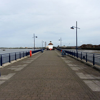
Erith owes its existence to the Thames and was, until the 1850s, essentially a small riverside port, given prominence by King Henry VIII's decision to open a naval dockyard there, approximately where the Riverside Gardens are now. Henry's famous warship, Henri Grâce à Dieu, was fitted out there in 1515. Up until the 19th century Erith remained a popular anchorage. Ships often discharged some cargo there to reduce their displacement before entering the shallows upstream.
Since the late 1990s Erith has been undergoing significant changes, with the Erith Western Thames Gateway project being the culmination.
The regeneration falls within the remit of the Thames Gateway project, with Erith as a key focus for Bexley Council, as its only population centre on the River Thames.
Since 2000 a significant number of new flats have been constructed by the river by private companies. The Erith Western Gateway will include a significant number of new riverside flats, and is expected to continue the regeneration of the area, hitherto a large underused area of the town centre. Bexley Council is seeking to produce a mixed-use development with a potential of 6,000 sq.m of new commercial space and over 500 new homes. It has announced the selection of Crest Nicholson/Orbit South to take forward the Erith Western Gateway regeneration scheme. The timing and construction of the gateway is as yet uncertain.
|
 Feel free to Email me any additions or corrections Feel free to Email me any additions or corrections
LINKS AVAILABLE TO YOUR SITE
| |


