
Like us on Facebook
PLACE NAMES


|
|
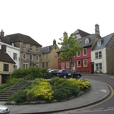
Calne
|
 |
|
|
In AD 978, Anglo-Saxon Calne was the site of a large two-storey building with a hall on the first floor. It was here that St Dunstan, Archbishop of Canterbury met the Witenagemot to justify his controversial organisation of the national church, which involved the secular priests being replaced by Benedictine monks and the influence of landowners over churches on their lands being taken away. According to an account written about 1000, at one point in this meeting Dunstan called upon God to support his cause, at which point the floor collapsed killing most of his opponents, whilst Dunstan and his supporters were in the part that remained standing. This was claimed as a miracle by Dunstan's supporters.
In 1086 Calne may already have been, as it was later, a market town on the main London-Bristol road. The church in it was well endowed. 74 or more households were held almost outright by burghal tenure (as citizens of a borough), and the lordship of its large outlying land was divided between the king (of whom 45 burgesses were tenants) and the church. In the Middle Ages the king's successor as the lord of Calne manor and, as owner of the church's revenues, the treasurer of Salisbury Cathedral, each had the right to hold a market and a fair in the town, with two triangular market places or fair grounds. A modest hospital was provided on a modest endowment from 1248 until it provided no accommodation in 1546 and was sold two years later by the Crown.
In common with the surrounding villages, hotels cater to the following attractions:
- Cherhill White Horse - 3.4 mi (5.5 km) east of central Calne, carved into the south face of Cherhill Down in 1780, situated south of Cherhill village and clearly visible from the A4 Calne - Marlborough Road. Cherhill Down rises to 860 feet (260 metres).
- Lansdowne Monument - situated close to the summit of Cherhill Down, the 125 ft (38 m) stone needle provides views of Calne and the surrounding landscape. The mountains of South Wales and Cleeve Hill in the western Cotswolds can be seen on exceptionally clear days, as well as the cities of Bath and Bristol.
- Bowood House (including the 2/3 mi (1.1 km) Bowood Lake) - an English Heritage site, is 3.1 mi (5.0 km) to the west of Calne, accessible via the village of Derry Hill.
- Avebury stone circle & Avenue (UNESCO World Heritage Site) - Europe's largest neolithic stone circle site is 7 1/2 mi (12.1 km) east of Calne on the A4361 route towards Wroughton.
- Silbury Hill, the largest neolithic structure in Europe, is situated 7 mi (11 km) east of the town on the A4 route 1/2 mi (800 m) east of Beckhampton.
- West Kennett Long Barrow - the 5,500-year-old neolithic long barrow/tomb is situated 7 1/4 mi (11.7 km) east of Calne, south of the A4 route east between Beckhampton and West Kennett.
- North Wessex Downs AONB - the range's highest summit is the Tan Hill-Milk Hill ridge near Allington, at 968 ft (295 m) above sea level, 9 mi (14 km) southeast of Calne. This area is popular with hill walkers, and several hills over 820 ft (250 m) high are situated adjacent to Calne.
- Salisbury Plain - the northernmost point of the plain is 12 mi (19 km) to the southeast of Calne, slightly to the southeast of Devizes.
- Stonehenge is 24 mi (39 km) south of the town.
Blackland Lakes is a large camping site on the southern edge of Calne which is popular with anglers and tourists alike. The 'lakes' themselves are in fact large angling pools.
|
 Feel free to Email me any additions or corrections Feel free to Email me any additions or corrections
LINKS AVAILABLE TO YOUR SITE
| |

