
Like us on Facebook
PLACE NAMES


|
|
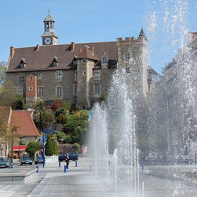
Montluçon
|
| |
Montluçon is a commune in central France on the Cher river. It is the largest commune in the Allier department, although the department's préfecture is located in the smaller town of Moulins. Its inhabitants are known as Montluçonnais. The town is in the traditional province of Bourbonnais and was part of the mediaeval duchy of Bourbon.
Montluçon is located in the northwest of the Allier department near the frontier of the Centre and Limousin regions.
Montluçon is linked with surrounding regions and towns via 4 main road axes, plus the highway A71 from Orléans to Clermont-Ferrand; through a railway linking in the North Vierzon then Paris (3-5h). Formerly the canal de Berry linked Montluçon towards the north.
Montluçon is 106 kilometres (66 miles) south of Bourges, 340 km (211 miles) from Paris, 95 km (59 mi) from Clermont-Ferrand, 280 km (174 mi) (3h) from Lyon, 150 km (93 mi) (2h) from Limoges and 400 km (249 mi) from the Atlantic coast.
Montluçon is close to the Méridienne verte (an architectural project marking the Paris meridian) and to the Greenwich meridian.
 Feel free to Email me any additions or corrections Feel free to Email me any additions or corrections
LINKS AVAILABLE TO YOUR SITE
| | |

