
Like us on Facebook
PLACE NAMES


|
|
Sampzon
|
| |
Sampzon is located on the right bank of the Ardèche River, south of the confluence of the Chassezac which it shares with the commune of Saint-Alban-Auriolles to the north.
The commune is limited to the north, east and south-east by the Ardèche for about 5.7 km, to the south by the ridge line of the Costes du Moure Frey, to the west by the Côtes de la Serre de Pinet and to the north-west by the Chassezac for about 1 km.
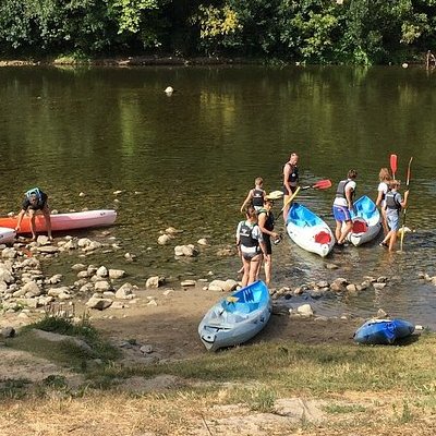
With the presence of the Ardèche and Chassezac, the other remarkable physical feature of the commune is the Rocher de Sampzon. It is only 381 meters above sea level but its unique silhouette in an inclined table and its relative isolation make it an obvious visual landmark and a superb observation lookout. Clinging to 300 m altitude on its northern flank, the old village overlooks the Ardèche by more than 200 meters. The northeast buttress of the Rock forces the river to deviate from its direction in a long loop to the east. However the highest point of the commune is not the Rocher but a summit of the crest of Costes located at the southern tip of the commune, at the meeting point with the communes of Salavas to the south-east and Grospierres to the south-west, at the bottom of the valley of the Cruzières stream (465 meters).
About half of the territory of the commune is covered by wood. Fields are still present in the valleys, next to the many campsites on the edge of the commune along the two main rivers: nine campsites are located in the commune, or about 1,200 placements, 70% of which are in flood zones, i.e. in or bordering the major bed of the rivers concerned. Predominantly viticultural agriculture and tourism are the two main resources of the commune1.
In addition to having for limits the Chassezac to the north-west and the Ardèche from north to southeast, the commune is crossed from south to north by the Vallier stream, a small seasonal tributary of the Ardèche which drains the northern flank of the Moure Frey, flows north by carving a valley west of the Rocher and Sampzon, and empties into the Ardèche 150 m downstream of the confluence of the Chassezac.
Le Vallier has several names along its route. On its first 900 m it is called the stream of Cruzières; on the next 1.2 km it is the stream of Bertras. Then it passes in front of the valley of the Aiguille on its left bank and takes the name of stream of the Aiguille. 700 m downstream it receives the stream of Pas du Bas on the left bank and the stream of the Fontaine de la Boutique on the right bank 50 m further. There is the hamlet of Vallier from which he takes and keeps the name for the remaining 1.8 km of his route. Downstream of Vallier it passes through the Gorge on the right bank, receives on the left bank the stream of Bertoir, and passes the castle of the Bastide before arriving in the alluvial plain formed by the Chassezac (about 1.3 km wide here at its confluence, including about 600 m in the town of Sampzon) to flow into the Ardèche.
A micro-power plant is located in the commune, at the Moulin called "old mill of Sampzon", on the course of the Ardèche. It has been operated since 1988 by the Société d'Énergie Hydro-Électrique Ardéchoise (SEHEA). Note that electricity production is abundant in the region, and not only of hydroelectric origin: the Tricastin nuclear power plant is 32 km away, the Cruas nuclear power plant is 40 km away and the Marcoule nuclear site is 43 km away.
With its striking floods of suddenness and by the increase in flow, the combination of the two sometimes causing waves of 50 cm to one meter in height, the Ardèche is accustomed to the Cevennes episodes and the most monitored river of the department. Its centennial floods, with 6,750 m3/s in Vallon, have the same order of flow as a flood of the Rhône in Viviers. The reference flood is that of 1890, the most devastating known with 17.3 meters of water at the mill of Salavas.
Chassezac's share of this power deployment is about half. He too can show waves from 50 cm to one meter, and he too is one of the most monitored rivers in the Ardèche. Several clipping dams have been built on its course to limit the amplitude of floods downstream.
 Feel free to Email me any additions or corrections Feel free to Email me any additions or corrections
LINKS AVAILABLE TO YOUR SITE
| | |
