Águilas is a municipality and seaport of southeastern Spain, in the province of Murcia. It is situated at the southern end of Murcia's Mediterranean coastline, otherwise known as the Costa Cálida, near the border with the Province of Almería.
The municipality has a population of 35,000 people (INE 2017), and an area of approximately 253.7 km², with some 28 km of coastline. It is 105 km southwest of the provincial capital, Murcia.
Águilas is built on the landward side of a small peninsula, between two bays-the Puerto Poniente on the south-west, and the Puerto Levante on the north-east. The Puerto de Aguilas, close to the centre of the city, is flanked on its western side by a large rocky hill. On its top sits the Castillo de San Juan de las Águilas castle, built in the 18th century on the site of a much older Carthaginian fortification. King Charles I ordered its refurbishment in 1530 to help protect the coast from Turkish and Algerian incursions. The rock cut from the south side of the castle's hill, and which left it with an almost vertical wall up to the castle on that side, was used to expand Aguilas' port in the early 20th century. The city sits at the end of the Murcia to Aguilas RENFE train service.
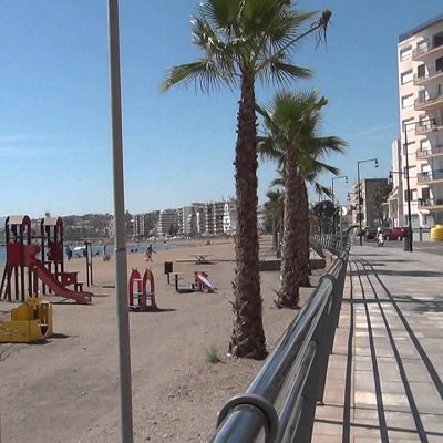
Águilas has numerous beaches along a 25-kilometre stretch, including Cala de la Cueva de las Palomas, Cala de la Herradura, Playa Amarilla, Playa de Calabardina, Playa de Calacerrada or Playa de Los Cocedores, Playa de Cope, Playa de la Cañada del Negro, Playa de la Casica Verde, Playa de la Cola, Playa de la Colonia, Playa de la Galera, Playa de la Higuerica, Playa de la Rambla Elena, Playa de las Pulgas, Playa de Poniente, Playa del Arroz, Playa del Barranco de la Mar, Playa del Pozo de las Huertas, Playa del Pocico del Animal, Playa del Pozo, Playa El Rafal, Playa del Charco, Playa del Sombrerico, Playa Ensenada de la Fuente, Playa de Calabarrilla, Playa El Hornillo, Playa de Las Delicias, Playa de Levante, Playa del Matalentisco, Playa La Tortuga, Playa de Calarreona, Playa La Carolina and Playa del Pino. Most are small and intimate.
Three kilometres northeast of Aguilas is la Isla del Fraile (Monk Island), so named thanks to the similarity of the island's silhouette to a monk's hood. The island has a small rocky beach and a very steep geography. The top of the island gives way to a sudden drop down to the sea on the island's south side. The island was inhabited by the Romans, who used it to export fish byproducts to Rome in amphorae. The remains of a Roman wall are still visible, as are a couple of structures of the early 20th century built by an eccentric British lord who lived on the island and used it for contraband purposes.
Adjacent to the island, on the mainland, is la Playa Amarilla, which is the coastal delineation of La Isla del Fraile residential development. This property was initially developed by Dr. Antonio Sáez Jimenez with basic infrastructure, including construction of the first road over the mountain and down to the beach, as well as the planting of thousands of trees; the development was known as Playa Niagara through the 1970s and 1980s. In the 1970s, graves from the Roman era were discovered near the property's coast, facing the island. The flora in the area is very dry, mostly characterized by shrublands such as the Ziziphus lotus, named Azufaifo locally.
 Feel free to Email me any additions or corrections Feel free to Email me any additions or corrections
LINKS AVAILABLE TO YOUR SITE
| |