Dungarvan is a coastal town and harbour in County Waterford, on the south-east coast of Ireland. Prior to the merger of Waterford County Council with Waterford City Council in 2014, Dungarvan was the county town and administrative centre of County Waterford. Waterford City and County Council retains administrative offices in the town. The town's Irish name means "Garbhann's fort", referring to Saint Garbhann who founded a church there in the seventh century. The town lies on the N25 road (European route E30), which connects Cork, Waterford and Rosslare Europort.
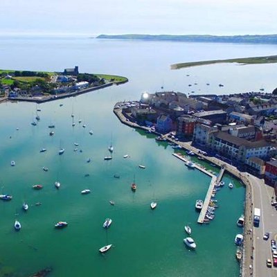
Dungarvan is situated at the mouth of the Colligan River. Dungarvan Harbour as such is formed by The Quay (on the town side) and The Causeway. A single-span bridge was built in the late 18th century by Lord Devonshire to link Dungarvan with Abbeyside and indeed Waterford via said causeway. Outside the harbour, a 3-kilometre (1.9 mi) sandbar, "The Cunnigar" (Irish An Coinigéar) defines the western limit of the 4-kilometre (2.5 mi) wide Dungarvan Bay. The Cunnigar encloses the estuary of the River Brickey which flows out to sea at Abbeyside without actually joining the Colligan. The two estuaries are separated by "The Point".
|