Adelboden lies in the west of the Berner Oberland, at the end of the valley of the Engstlige river, which flows in Frutigen into the Kander river.
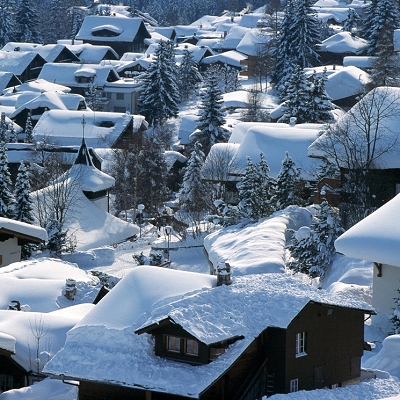
Adelboden is a traditional Swiss mountain village on a terrace looking south to the Engstligen waterfalls. Also part of the village are the inhabited valleys of Gilbach, Stigelschwand, Boden, Hirzboden, and Ausserschwand. Church and main street are at 1,350 m (4,430 ft), the highest point of the area is the Grossstrubel with 3,242 m (10,636 ft), the lowest point is at 1,045 m (3,428 ft) in the Engstligen valley.
The vegetation is alpine and sub-alpine, partially wooded, the slopes, the plateaus, and terraces usually alp meadows.
The most salient mountains are Lohner (3,049 m (10,003 ft)), Steghorn (3,146 m (10,322 ft)), Wildstrubel (3,243 m (10,640 ft)), Fitzer (2,458 m (8,064 ft)), Tschenten (2,025 m (6,644 ft)) (mountain railway) and Gsür (2,708 m (8,885 ft)).
Of the built up area, housing and buildings made up 1.5% and transportation infrastructure made up 0.8%. Out of the forested land, 14.4% of the total land area is heavily forested and 3.0% is covered with orchards or small clusters of trees. Of the agricultural land, 8.5% is pastures and 32.9% is used for alpine pastures. All the water in the municipality is flowing water. Of the unproductive areas, 9.6% is unproductive vegetation, 25.6% is too rocky for vegetation and 1.1% of the land is covered by glaciers.
On 31 December 2009 Amtsbezirk Frutigen, the municipality's former district, was dissolved. On the following day, 1 January 2010, it joined the newly created Verwaltungskreis Frutigen-Niedersimmental.
|