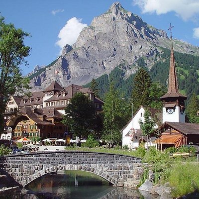
Kandersteg is located on the northern side of the Bernese Alps at an altitude of 1,200 meters (3,900 ft) above sea level at the foot of the Lotschen and Gemmi Passes. The village, with 1200 inhabitants, lies in the upper Kander Valley. The municipality extends over a territory encompassing the valleys of Gastern (upper Kander Valley) and Oeschinen. It includes the villages of Kandersteg and Gastern.
Kandersteg is surrounded by high mountains. The Balmhorn (3,698 m [12,133 ft]), bordering the canton of Valais to the south, is the highest in the valley; it is followed by the Bluemlisalp (3,663 m [12,018 ft]), east of the village. The Gross Lohner (3,049 m [10,003 ft]) is the highest summit between the Kander Valley and the valley of Adelboden on the west.
The Bunderchrinde Pass (2,385 m [7,825 ft]) connects Kandersteg to Adelboden, whilst the Hohturli Pass (2,778 m [9,114 ft]) on the east connects Kandersteg to Griesalp in the Kiental valley. Neither pass carries a road, but both form part of the Alpine Pass Route, a long-distance hiking trail across Switzerland between Sargans and Montreux that passes through the village.
The largest lake in the valley is lake Oeschinen. It is located at 1,578 m (5,177 ft) east of Kandersteg, at the foot of the Bluemlisalp massif. The Gastern Valley is an almost closed off valley. At the upper end of the valley lies the Kander Glacier, the source of the 44 km (27 mi) long Kander river. The Gastern Valley is on the way to the 2,700 m [8,900 ft] high Lotschen Pass.
Part of the municipality is located within the Jungfrau-Aletsch area, declared a UNESCO World Heritage Site in 2001 and extended in 2007. The area comprises Lake Oeschinen and the Gastern Valley.
Kandersteg has an area of 134.56 sq km (51.95 sq mi).
Of the built up area, housing and buildings make up 0.4% and transportation infrastructure make up 0.4%. Of the forested land, 8.8% of the total land area is heavily forested and 1.3% is covered with orchards or small clusters of trees. Of the agricultural land, 1.2% is pastures and 12.0% is used for alpine pastures. Of the water in the municipality, 1.0% is in lakes and 0.9% is in rivers and streams. Of the unproductive areas, 10.4% is unproductive vegetation, 43.1% is too rocky for vegetation and 18.6% of the land is covered by glaciers.
The municipality is located in the upper most section of the Kander river valley, along with parts of the Gastern and Oeschinen valleys and part of the Blumlisalp mountain. It consists of the Bauert of Kandersteg, which includes the village of Kandersteg and the Bauert of Gastern.
On 31 December 2009 Amtsbezirk Frutigen, the municipality's former district, was dissolved. On the following day, 1 January 2010, it joined the newly created Verwaltungskreis Frutigen-Niedersimmental.
|